The United Nations has backed an African-led campaign to change how the world is visually represented on maps, in a vote that is less about replacing an old cartographic tool than challenging the assumptions it has helped embed for generations. But the question remains: what is in it for Africa?
It appears symbolic or just merely a psychological upliftment for the serially downtrodden continent. However, one little-known group, The Travelling Company (TTC), is reading a spiritual meaning and urging a cacophony of prayers from the African Christendom for a restoration of the position of the continent where mankind allegedly originated.
It is also urging, in prayers, according to its spokesman, Timzin Nuhu, a spiritual and psychological break from the powers of western, mid-eastern, and eastern countries in their battle for the soul and resources of the continent.
“We started this more than a year ago, long before it became an issue in the UN and we believe other independent groups and people are involved. We wait to see where it all ends in the hands of the Director,” he said.
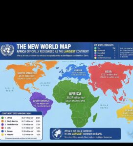
The UN General Assembly on Friday adopted a non-binding resolution encouraging governments, schools, international organisations and technology companies to use maps that more accurately represent the relative size of the world’s regions.
The resolution passed by 164 votes to one, with six countries abstaining. The United States was the only country to vote against it, while Estonia, Georgia, Lithuania, Moldova, Serbia and Ukraine abstained.
Led by Togo on behalf of the African Group and backed by the African Union, the initiative centres on the widespread use of the Mercator projection, a map first developed by Flemish cartographer Gerardus Mercator in 1569.
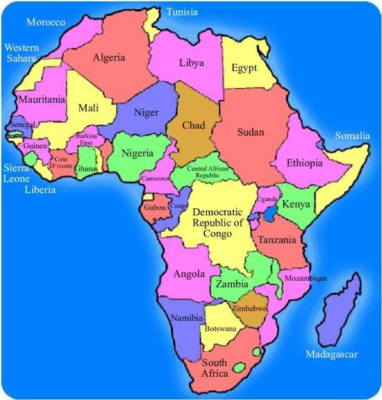
Mercator remains valuable for navigation because it preserves direction. But it significantly exaggerates the apparent size of landmasses as they move away from the Equator. Africa, for example, is roughly 14 times larger than Greenland, although the two can appear surprisingly similar in size on a conventional Mercator map.
That distortion is at the heart of Africa’s campaign.
So, what changes?
In practical terms, very little changes immediately. In symbolic and educational terms, the vote could matter considerably.
The UN resolution does not ban Mercator, mandate a single replacement or alter any national border. It is not a treaty and does not change the physical geography of the planet.
Instead, it gives international backing to the idea that when maps are used to compare the size of continents, they should not systematically distort those comparisons.
The resolution encourages the use of equal-area projections such as Equal Earth, developed in 2018, which shows continents in much closer proportion to their actual surface areas.
For African governments, that distinction matters because maps are not merely technical instruments. They are also among the first images through which people learn about the world.
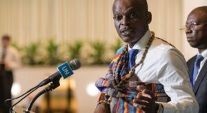
Togo’s Foreign Minister Robert Dussey framed the argument in those terms before the vote: “A fair map does not change the geography of the world, it changes how we see the world.”
The underlying claim is that repeatedly seeing Africa depicted as smaller than it really is can reinforce a psychological and cultural imbalance — particularly when such images are encountered in classrooms, textbooks, media and digital platforms.
A symbolic victory for Africa
The overwhelming vote is therefore significant less because it will immediately change the maps people use and more because it gives diplomatic legitimacy to an African argument about representation.
All 55 African Union member states backed the campaign. By taking the issue to the UN, African governments have turned what might otherwise appear to be a technical debate among cartographers into a conversation about education, historical perception and the legacy of colonial-era representations.
The argument is not that Mercator was deliberately designed to diminish Africa. It was created for a specific navigational purpose more than four centuries ago.
The problem, African governments argue, is what happened afterwards: a projection designed for sailors became one of the world’s most familiar representations of the planet, including in contexts where navigation was irrelevant and the relative size of continents mattered.
An equal-area map cannot solve every problem either. Because the Earth is spherical and maps are flat, every projection involves compromises involving shape, distance, direction or area.
The point of the UN initiative is therefore not that one map is universally correct, but that different maps should be used for different purposes.
Why was the United States alone?
Washington’s opposition gave the vote an additional political dimension.
The US representative characterised the initiative as part of what Washington called a “radical ideological project”, objecting in particular to references to concepts including “cognitive justice” and “memorial reparation”.
The American position was that such language risked diverting the UN from more urgent international problems and further damaging the organisation’s credibility.
The result nevertheless left Washington isolated: 164 countries supported the resolution, while the United States was the sole vote against it.
That does not mean the vote represents a global consensus that Mercator should disappear. Rather, it highlights a divide over whether questions of representation and historical perception belong within the UN’s agenda.
France sends a different signal
The vote also coincided with a striking decision from France.
The French foreign ministry announced that it would stop using Mercator for its maps and adopt the Eckert IV projection, another projection designed to represent land areas more proportionately.
France’s decision gives the African campaign a powerful endorsement from a major European country.
It also demonstrates the distinction at the centre of the debate: abandoning Mercator for some purposes does not amount to declaring the projection “wrong”. It means acknowledging that a map optimised for navigation is not necessarily the best map for teaching people how large the world’s continents actually are.
Ukraine highlights the complications
The abstention by Ukraine illustrates another reason why changing maps is not entirely a neutral exercise.
Kyiv raised concerns about how alternative projections could visually represent territories affected by Russia’s occupation. The European Union, while supporting the resolution, stressed that changing a map projection must not be interpreted as changing borders, sovereignty or the legal status of disputed territories.
That distinction is crucial.
The UN vote is about cartographic representation, not territorial recognition. Equal Earth or Eckert IV can change how large a country or continent appears without changing where its borders legally lie.
The bigger picture
The immediate impact of Friday’s resolution will depend on whether governments, educators, publishers and technology companies actually change the maps they use.
There is no enforcement mechanism requiring them to do so.
But that may miss the larger significance of the vote.
For decades, the Mercator projection’s distortions have been familiar to cartographers but largely invisible to ordinary map users. The UN resolution puts that problem into an international political conversation and gives African governments a platform to argue that visual representation is itself a form of power.
If schools increasingly use equal-area maps when teaching geography, if international organisations adopt them for comparisons and if digital platforms offer more context about map projections, the long-term effect could be less about one map replacing another and more about people becoming aware that every map is a choice.
That is the real “so what?” of the UN vote.
The world has not been redrawn. Borders have not moved. Mercator has not been outlawed.
What has changed is the conversation about whose perspective is reflected when the world is put on a page – and whether a map used to teach billions of people about the planet should continue to make some parts of that planet look far smaller than they really are.